
Insight
Published on March 9, 2026
The “Code of Practice for Road Signs”, established by the Indian Roads Congress (IRC), serves as the national benchmark governing the design, placement, and uniformity of all traffic control devices across Indian roads, particularly the National Highway network. This standard defines the engineering, visual, and positional attributes of traffic signs to ensure uniform driver interpretation and operational consistency across diverse roadway environments. Its primary objective is to enhance road safety, minimize driver confusion, and promote efficient traffic flow through a standardized visual communication system. The code classifies road signs into three distinct functional categories: (1) Mandatory signs – Addresses legal requirements and traffic regulations. (2) Cautionary signs – Addresses to Warn signs for drivers of potential hazards or changes in road/ subway/ highway conditions. (3) Informatory signs – A guide to direct and sahre generalized information to facilitate navigation. Each category is meticulously standardized for shape, color, typography, retroreflectivity, and mounting height, ensuring consistency under various lighting and environmental conditions. This uniformity enables a driver from any region to instantly recognize and respond to a sign’s message, reducing decision time and preventing accidents.
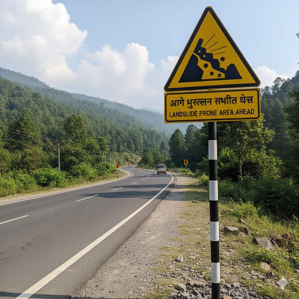
The two signs analyzed from National Highway 67 exemplify the practical application and operational significance of the IRC:67 standard.
The first sign, integrating route information with a temporary diversion warning, enhances navigational clarity while alerting drivers to immediate, short-term alterations in traffic movement.
The second sign, indicating a landslide-prone zone, represents long-term hazard awareness and environmental risk management.
Together, they embody a comprehensive safety framework—one addressing dynamic traffic conditions, the other persistent environmental risks. By delivering pre-emptive, standardized visual information, these IRC:67-compliant signs empower drivers to make informed and timely decisions, thereby reducing accidents and supporting safe, predictable mobility across India’s expanding highway network.
(1) AI-Based Signage Detection: Computer vision algorithms trained on IRC:67 standards automatically classify, validate, and identify signage types during road surveys.
(2) Geospatial Mapping: Each detected sign is geotagged with precise coordinates and chainage references, enabling spatial correlation with survey baselines.
(3) Compliance Verification: Field imagery and LiDAR data are cross-referenced with IRC:67 specifications to detect non-compliant, damaged, or missing signs.
(4) Road Safety Analytics: Non-compliance patterns are aggregated into heatmaps and dashboards for maintenance prioritization.
Integration with Asset Management Systems: Geo-referenced signage data ensures interoperability with NHAI.
Thus, the IRC:67 standard not only governs physical signage but also forms the digital backbone for automated road audits, AI-driven inspections, and geospatial safety intelligence systems such as Hanu AI’s Road Athena.